Tuesday, April 21
Start: Info kiosk near Hwy 94 near Lake Powell
End: Somewhere among the Red Ledges.
Miles: 10.1
With some anxiety, we headed off from Hwy 95 into no-man's land just when the sun was starting to beat down with a noticeable force. For me, the anxiety emerged from the required chimney ascent out of the side canyon we would soon turn into. For Caron, the whole big picture of taking off into a hot desert with no good water sources for the next 27 miles, with extremely heavy packs, and away from what at least appeared to be a semblance of civilization seemed to get the best of her. We met a solo mountain biker on the road up to the side canyon whose camp we passed along the way. Many of the people we've met so far are out here for the same reasons we are-- to experience this awe-inspiring and rugged landscape-- but have a distinctively different modus operandi of exploration. In this dude's case, he used his truck to establish a base camp and his mountain bike for exploratory excursions. It always interests me to see the various schemes people devise for being out here; I'm sure we'll witness many more along the way. One thing is for sure, putting on a pack and eliminating the tethers achieves the greatest independence of all. As alluded to earlier, it does occasionally result in some anxious moments.
We found the location of the chimney route by early afternoon and began the slow plodding ascent up to it as the sun seemed to increase its intensity. When we finally arrived, we realized that the climbing was far easier and less extensive then any of the cliff routes we had so far accomplished. With a quick lift of the packs, we were soon up on the rim resting in the shade with at least some of the morning's anxiety now dissipated.
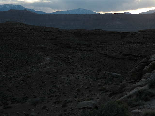
The next twist to this leg was navigating the topographical landmark known as the "Red Ledges". After staring at the topo maps during the months leading up to this hike, I still had trouble imagining just what these ledges actually looked like. Ultimately, they were nothing like what I had in mind. The topography on top was somewhat flat with sage and junipers dotting the landscape. There was an enormous sandstone monolith to the north called "The Block" that clearly dictated a westerly path around it and through the ledges. The ledges themselves were composed of maroon-colored broken shales, eroded into a stair-step pattern and dissected into bewilderimg array of ravines. As we gained the high ground above them, I could clearly see why this maze-like landscape had earned its own title on the topographic map.
To the east I noticed a curious familiar landmark known as "The Sewing Machine" (I'm guessing it was named long before mass production of the modern units). We had seen this notable landmark at points much earlier on the trip, far to the west in Canyonlands, then far to the northwest near Fable Valley, and now it was just a few miles to our east (actually part of the same dominating sandstone formation as The Block). We had walked a huge southerly arc around the Sewing Machine. Prominent landmarks like these were the means by which natives, explorers and pioneers oriented themselves on long journeys. I'm sure cattle herders and wayward long-distance hikers still use them if need be.
We made our way northwest around the block and momentarily made the mistake of descending too far down into the Ledges. 
Day 15
Wednesday, April 22
Start: Somewhere among the Red Ledges.
End: 4 miles up Hatch Canyon
Miles: 11.5
Determined to make short order of the remaining ~3.5 miles until the descent into Fiddler Cove Canyon, we were up early and soon renegotiating with the Red Ledges. Our strategy so far had been to stay elevated so as not to get sucked into a wayward ravine. But now our direction of travel dictated a different path that cut directly across the flow of the ravines. Fortunately, the ledges appeared to coalesce into a slightly more manageable landscape and without too much errant maneuvering, we eventually approached the edge of the daunting Fiddler's Cove Canyon for the unnerving descent to its floor.
This canyon required a carefully executed 750-foot descent to the bottom-- with quite a few warnings from the guidebook authors who had earlier uncovered the only route down. We attempted to locate this route but couldn't seem to hone in on the obvious choice among a few potential breaks in the canyon rim. I thought I had located a viable route but whether it descended safely all the way to the floor would remain unknown until we were actually committed to taking it. With great trepidation that seemed to drain away our energy in the hot mid-day sun, we commenced descending a route which eventually didn't seem quite like the one described as the "only way down". We carefully inched our way down the steep-sided canyon and to our great relief it emptied onto a navigable scree slope via a short climb down a chimney. We had to remove our packs and lower them on ropes twice through this descent. If I had doubts that this was the officially decribed route down, they were forever put to rest when we finally viewed the safer route from the bottom. We were too far west to have seen it (see route commentary). I'm not exactly sure how this snafu occurred but I'm now fairly certain that there is at least and probably not more than two ways down this steep-sided canyon.
We arrived at the Dirty Devil river running critically short of good water. This was not a good prospect for us as this river only offered the nastiest water possible. The sediment load, though very high, is not the problem. The water has an alkali content that renders it nearly unpotable. More warnings from the guidebook authors concerning this water didn't help our psyche much either. Nonetheless, our route was 6 miles up this river canyon and an additional 6 miles up Poison Spring Canyon to a very nice spring-fed water source. We reluctantly filtered 4 liters of this marginal water in dubious hope that we could actually be sparing with it for the next 12 miles.
While gathering ourselves for the grueling, water-restricted miles ahead, we noticed that a large mid-afternoon rainstorm had socked in to the north some 20 miles away. In addition to fighting through willow and tamarisk thickets, muscling our way through quicksand traps, and having to contend with multiple fords of a river whose water wasn't fit for consumption, we now had to consider the prospect of a flash flood on this capricious river. The trip up the Dirty Devil corridor was really beginning to sound like pure hell to us so we began considering alternatives. Fortunately, the guidebook described an alternative high-water route that was beginning to sound like the one we wanted despite adding an additional 5 miles of walking before we could get to good water.
So we set off back up Fiddler's Cove Canyon for a short distance until we arrived at the mouth of Hatch Canyon. The walk up was easy and scenic on a slowly ascending gravelly wash bed-- definitely preferable to the Dirty Devil route. As the afternoon wore on and evening began to set in, our thirst dictated that we start taking in some of the bad water we were hauling up. I felt myself getting trapped into the dreaded cycle whereby the very water that you are drinking to quench your thirst makes you even more thirsty due to its salt content. What a terrible prospect with 14 more miles ahead where cold, delicious, spring-fed water awaited.
I remember a short story from my sophomore year in high school entitled "Wine in the Desert". It tells the story of an evil bandito that plunders a peaceful hacienda then takes the young boy residing there as his personal slave after murdering the rest his family. The boy becomes entrusted to the bandito. When it comes time to leave and continue his plundering the innocent, the bandito orders the boy to fill up two canteens before setting off across the perilously hot desert. The first canteen was filled with delicious, cold well water-- enough to get the bandito safely beyond the point of no return. The second canteen contained wine. The boy cleverly exacts revenge on the bandito by forcing him to eventually drink the wine due to the unbearable urge to consume liquid. As you can imagine, the bandito's death is slow and brutal as the alcohol dehydrates him even more. He even lances his own tongue to drink the blood. Contemplating this scenario was indeed a great way to pass the time on the long hot march up Hatch Canyon.
The sort of mental misery produced here degenerates the spirit. Whether the intense need to drink more and more water emanates from a physical need or from mental fixation is unclear. However, the exasperation of having to walk so far before truly quenching the thirst is undeniably intense. I began to dream of miraculously happening upon a spring gushing forth pure cold water. Oh the hell of the Dirty Devil!
As dusk approached 
Day 16
Thursday, April 23
Start: 4 miles up Hatch Canyon
End: Poison Spring Canyon
Miles: 12.6


We eventually peeled into a side canyon and camped next to some cottonwoods, only 6 miles from Hwy 95 and a much needed stay in the little town of Hanksville. About an hour after sunset we heard the sounds of an animal tromping up to the tent. Suddenly a dog was trying to nose his way into the tent. We immediately noticed from his whimpering that this little heeler was hurting pretty bad and was clearly lost. We fed him a bit of dinner leftovers and he seemed very content to dig out a windbreak next to the tent and rest his sore feet. This little animal was clearly asking for our help and fortunately for him he ran into two humans that think more of little animals than they do of most other humans. We decided to deal with a rescue plan in the morning.
Day 17
Friday, April 24
Start: Poison Spring Canyon
End: Hanksville, Utah
Miles: 6.0
After breakfast in the tent we stepped out to see exactly what predicament this little dog was in. He had a name tag with his owners contact info on it and so it seemed a simple matter to walk him out to the road and hitch into Hanksville to reunite him with his owner. This plan was foiled when it became apparent that the little guy couldn't walk 5 steps without having to get off his sore paws. He must have been running around for weeks out here with very little to eat, his companions long gone-- not even an ugly damn cow to chase around. We carried the little pooch out to the 4WD road in the main canyon, which had been completely devoid of any traffic the entire time. Deciding that the little dog would have to be driven out in a high-clearance 4WD vehicle, I set off to walk the remaining 6 miles to the highway and hitch into Hanksville to convince some good samaritan to rescue the dog. Caron remained with the poocher who was beginning to perhaps sense that his salvation might indeed be a reality.
After only 10 minutes of hitching, a friendly and very gigantic dude named Justin and his fiance picked me up. It turns out he knew the dog's owner and managed to place a call to his voicemail when we came into cell phone range. The owner was out on a cattle drive and wouldn't be pulling into town until that evening. Justin let me off at the Red Rocks Restaurant in Hanksville and said he could drive me back out to the turnoff later that afternoon, though he would have some trailered horses and wouldn't be able to rescue the dog. So I contemplated the situation over a juicy cheeseburger. Through conversations with some of the locals at the restauraunt, I sensed that the dog would be better off staying with someone other than his owner after he healed up, as his owner wasn't known for his humane treatment of cattle dogs. Justin dropped by as promised but didn't have a solution for rescuing the dog (and now Caron for that matter). Just then the owner of the restaurant and motel across the road interjected and graciously volunteered to drive the little dog out of the canyon.
We gassed up his truck and set off on the rescue mission. I quickly learned that Ed was born in Durango, CO, as I was, and about at the same time. He had moved away to Grand Junction when he was 5 but I knew of his half-brother who also grew up in Durango. The time passed quickly as we conversed about the ol' home town and we eventually happened upon Caron and the 
Saturday, April 25: Zero-day in Hanksville.
On our full day in Hanksville, we were fortunate to meet Mikayla, Ed's daughter. She and her boyfriend are going to start running cattle soon and she seemed willing to take Hatcher, as long as we dropped by after the hike to see how he was doing. This seemed like a good temporary solution for our little wayward four-footed friend. We were satisfied that Mikayla's ranch would be a good home for Hatcher, who would soon be buddies with her little boy, Adrian. We also ran into the elusive Zoner, the lone Hayduke hiker ahead of us. He had been moving very quickly on the trail and had taken a break to meet some friends coming across Utah from Colorado. We had a good time finally meeting up and sharing our experiences so far on the trail. We all agreed that the Hayduke was no ordinary long-distance trail and was indeed challenging as it includes so much routinely difficult cross-country routing.
Zoner also informed us that there is a solo female hiker ahead of him trail-named "Love Barge", and she is trucking through with determination and making good progress. At about that time, we ran into Joanne Chee from the Hite Marina store and she informed us that someone picked up a resupply package the day after we left Hite. So we got some hikers on this trail after all! It remains uncertain whether anyone will actually see each other on the trail itself.
Total Hayduke miles: 205
Hayduke canyon count:
Rock Canyon tributary (up)
Fiddler's Cove Canyon (down)
Hatch Canyon (up)
Dirty Devil River canyon (up)
Poison Springs Canyon (up)
Route commentary:
1. Against sound advice from the authors of the guidebook, we slithered our way down a different break in the rim of Fiddler's Cove Canyon than the one suggested in the guidebook. This is an alternative that works without too much inherent risk, but the safest route remains the officially advised one.
2. Tired of the willow-choked quicksand route up the Dirty Devil? Why not take scenic Hatch Canyon up to the Devil's rim and enjoy the wondrous sights and sounds of this infrequently-traveled corridor? You'll love the easy grade and lack of obstacles as you stroll past bizarre formations along the friendly, gravelly wash bottom. Enjoy a tasty, soothing drink of cool spring water served up by our gracious Fern Maidens at the 3.5 mile mark. You won't regret it. See you soon in lovely Hatch Canyon! (Brought to you by the Hatch Canyon Alternative)


No comments:
Post a Comment